Where the snow fell - New Year 2016
Where the snow fell - New Year 2016
Published : 06-Jan-2016 10:27
The folk at Pistehors (an excellent resource for French backcountry and Avalanche/Safety news and reports) have created this map showing where the snow of the past week has fallen.Pistehors wrote:This image shows where the recent snow has fallen in the French Alps. It is taken from Meteo France figures from 1st Jan through to the predictions for Wednesday's dumpage. Darker is more snow, from 115cm in the Bauges through to 10cm in the Mercantour to the south.
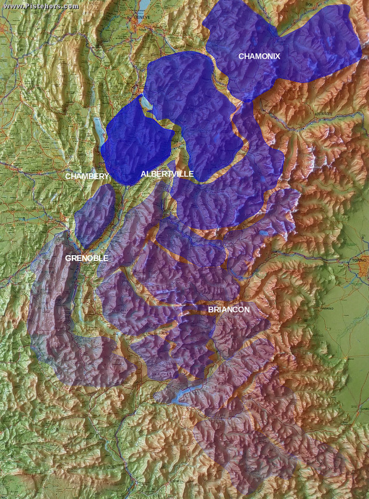
Image courtesy of and copyright Pistehors
More commentary on the snowfall is here - pistehors.com/where-the-recent-snow-has-fallen
We can see the series of Atlantic lows hit the West and North hardest and as the storms pushed inland and south the snowfall abated. This is fairly typical. The inner ranges are often dryer (rain shadow effect) except on the Italian Border where they can benefit from the famous "retour d'est" - a Mediterranean low pressure bringing copious amounts of snow to the Italian alps, but not this year.
The snow fell pretty much as forecast, with a few areas (mainly Pyrenees) getting a little less than expected.
Currently, there is a *LOT* more snow in the forecast; North and West Alps are looking at another metre of new snow over the next 3-4 days, with another metre looking possible for the following week - with very cold temperatures now on the cards for the middle of the month.
The even better news is that the next lot of snow should extend further South and East, hopefully bringing fresh into areas like the Dolomites that have missed out so far.
Hopefully, pistehors will update this map next week! 8)
Join the conversation : Discuss this in the J2Ski Forum (2 comments so far)
This news item has been viewed 79,577 times.