Piste and Terrain Maps for Sestrière
Sestrière Piste Map
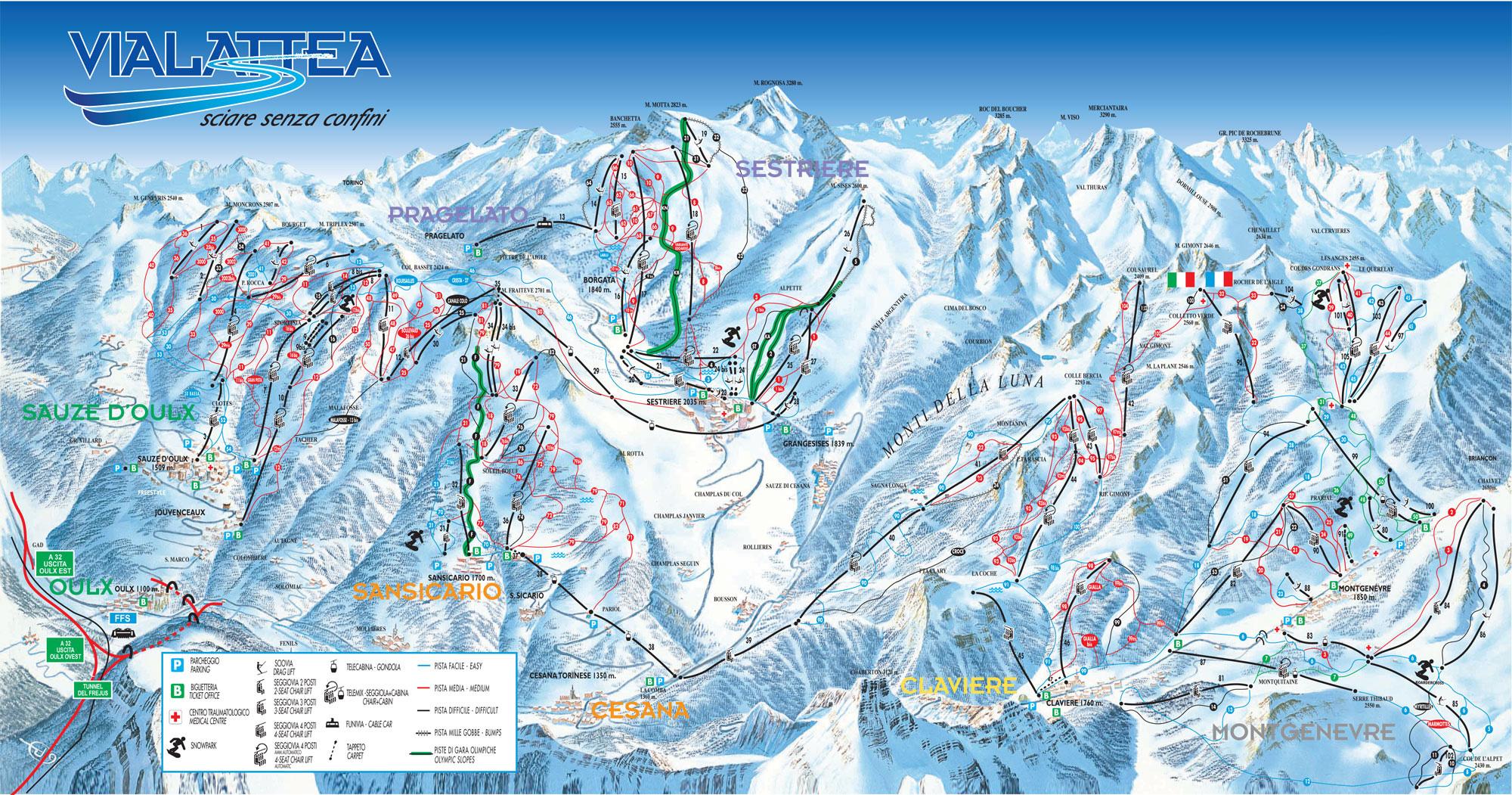
Trail Map for Sestrière - Ski Resort in Via Lattea, Italian Alps - 249 miles of Trail

Sestrière Location Map
Check the official Piste Map of Sestrière or use the map below to locate accommodation and ski shops...
Tap symbols for info. Tap  for Full-Screen. +/- Zoom in to find Hotels and Hire Shops.
Switch view to map of Montgenèvre, Sauze d'Oulx, Serre Chevalier or Sestrière.