Piste and Terrain Maps for Courchevel 1850
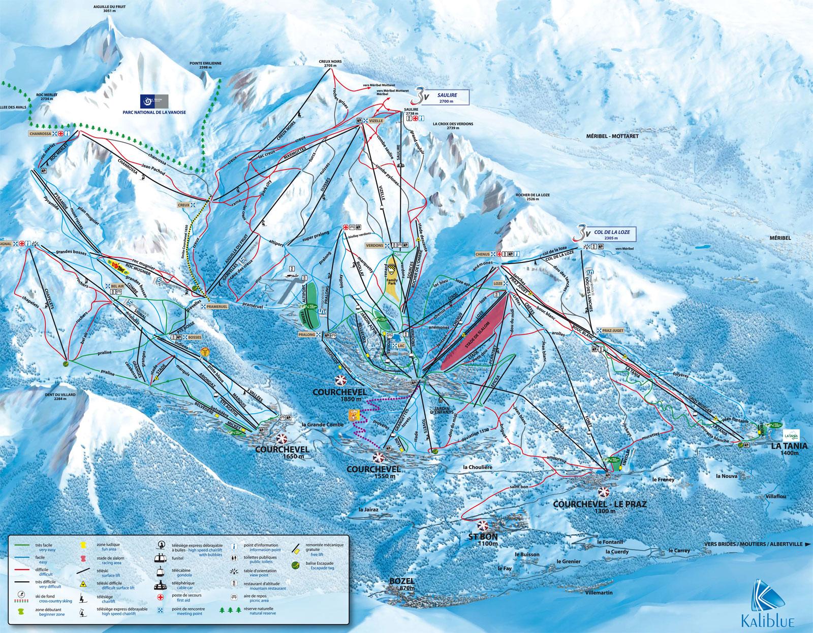
Courchevel 1850 Piste Map
Trail Map for Courchevel 1850 - Village in Courchevel, French Alps

Courchevel 1850 Location Map
Check the official Piste Map of Courchevel 1850 or use the map below to locate accommodation and ski shops...
Tap symbols for info. Tap  for Full-Screen. +/- Zoom in to find Hotels and Hire Shops.
Switch view to map of La Plagne, Les Arcs, Val Thorens or Val d'Isère.