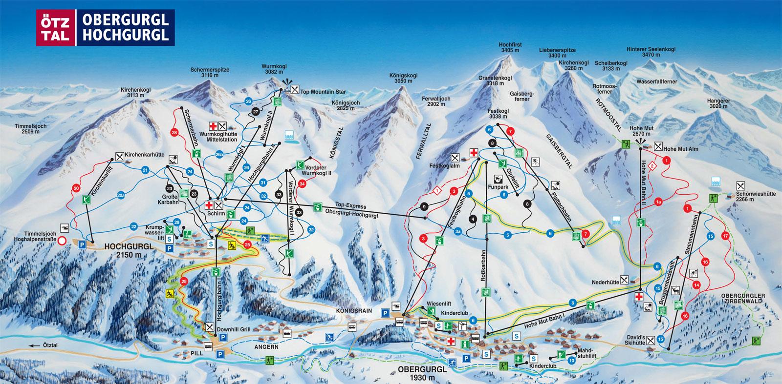
Piste and Terrain Maps for Obergurgl-Hochgurgl
Obergurgl-Hochgurgl Piste Map
Trail Map for Obergurgl-Hochgurgl - Ski Resort in Austrian Alps - 68 miles of Trail
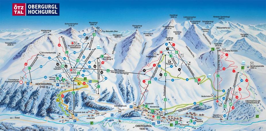
Obergurgl-Hochgurgl Location Map
Check the official Piste Map of Obergurgl-Hochgurgl or use the map below to locate accommodation and ski shops...
Tap symbols for info. Tap  for Full-Screen. +/- Zoom in to find Hotels and Hire Shops.
Switch view to map of Kühtai-Sellraintal, Obergurgl-Hochgurgl, Sölden or Vent.